
The light pollution map of the United States highlights areas with varying levels of artificial light intensity. Major urban centers, such as New York City, Los Angeles, and Chicago, exhibit the highest levels of light pollution, indicated by bright white and red zones on the map. These areas significantly obstruct views of the night sky, making astronomical observations challenging.
In contrast, rural regions and designated dark sky areas show minimal light pollution. Notable dark sky locations include parts of the western United States, such as the deserts of Nevada and Utah, as well as national parks like Yellowstone and Grand Canyon. These areas are marked by darker blue and black zones on the map, indicating excellent conditions for stargazing and astronomical activities.
By using this map, individuals can identify the best locations for dark sky viewing and plan their stargazing trips away from the bright lights of urban environments. There are also links below to zoomed light pollution in maps.
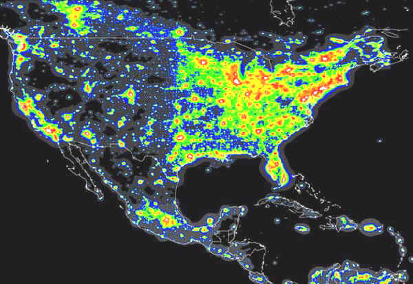
The dark areas are the best place to view the stars, milky way, and deep space objects.
Click here for a light pollution map of the eastern United States
As you can see from this light pollution map of the United States most of the light pollution is in the eastern half of the US. There is also a band of light pollution along the west coast.