
The light pollution map for Virginia and West Virginia provides a detailed view of artificial light levels across the two states, highlighting areas of high and low light pollution. Key features include:
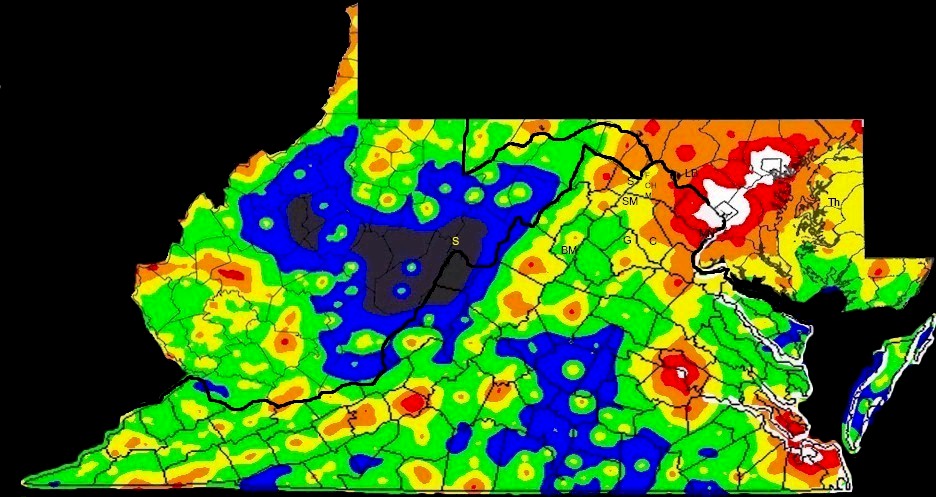
Urban Centers: Major cities such as Richmond, Virginia Beach, and Charleston exhibit high levels of light pollution, making them less suitable for stargazing.
Dark Sky Sites: The map identifies several regions with minimal light pollution, ideal for astronomical observations. Notable dark sky areas include:
- Shenandoah National Park (Virginia): Located in the Blue Ridge Mountains, this park offers some of the darkest skies in Virginia.
- Monongahela National Forest (West Virginia): Known for its expansive wilderness and minimal light pollution, this forest is a prime location for stargazing.
Transition Zones: Suburban and rural areas exhibit moderate levels of light pollution, with varying visibility of celestial objects depending on proximity to urban centers.
Dark Sky Parks and Reserves: The map highlights designated dark sky parks and reserves, certified by organizations like the International Dark-Sky Association (IDA), ensuring protected environments for night sky observation.
Overall, the map serves as a valuable resource for identifying optimal locations for stargazing and understanding the impact of light pollution across Virginia and West Virginia.